
Radan topographic map
Interactive map
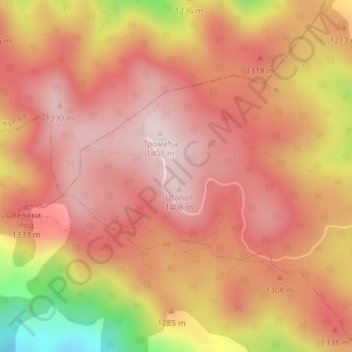
Click on the map to display elevation.
About this map
Name: Radan topographic map, elevation, terrain.
Average elevation: 1,272 m
Minimum elevation: 984 m
Maximum elevation: 1,402 m
Radan (Serbian Cyrillic: Радан) is a mountain in southern Serbia, near the town of Kuršumlija. Its highest peak, Šopot, has an elevation of 1,408 meters above sea level.
Other topographic maps
Click on a map to view its topography, its elevation and its terrain.
Dobra Voda
Serbia > Central Serbia > Jablanica Administrative District > Bojnik Municipality
Dobra Voda, Bojnik Municipality, Jablanica Administrative District, Central Serbia, Serbia
Average elevation: 772 m