
Unecha topographic map
Interactive map
Click on the map to display elevation.
About this map
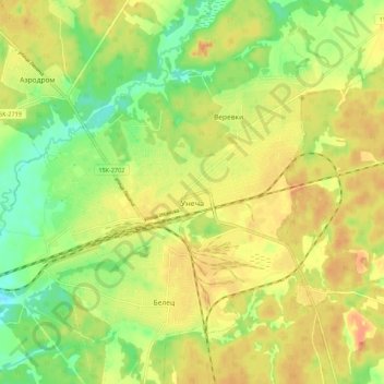
Name: Unecha topographic map, elevation, terrain.
Average elevation: 186 m
Minimum elevation: 162 m
Maximum elevation: 205 m
Other topographic maps
Click on a map to view its topography, its elevation and its terrain.
Найтоповичское сельское поселение
Russia > Bryansk Oblast > Unechsky District
Average elevation: 171 m