
Wright Patman Lake topographic map
Interactive map
Click on the map to display elevation.
About this map
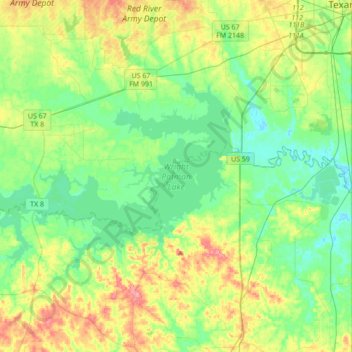
Name: Wright Patman Lake topographic map, elevation, terrain.
Location: Wright Patman Lake, Cass County, Texas, United States (33.20790 -94.50470 33.36206 -94.16027)
Average elevation: 87 m
Minimum elevation: 58 m
Maximum elevation: 147 m
Other topographic maps
Click on a map to view its topography, its elevation and its terrain.