Geolocate

Chandrabani topographic map

Click on the map to display elevation.

About this map

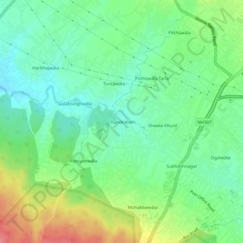
Name: Chandrabani topographic map, elevation, terrain.

Location: Chandrabani, Dehradun, Uttarakhand, 248001, India (30.26503 77.95869 30.30503 77.99869)

Average elevation: 607 m

Minimum elevation: 577 m

Maximum elevation: 663 m

Other topographic maps

Click on a map to view its topography, its elevation and its terrain.

Rispana River

India > Uttarakhand > Dehradun > Dehradun

Average elevation: 624 m

Gear up for your next adventure:

🧭Professional Hiking Compasses - High-precision liquid-filled compasses for map reading and orientation
🔦Outdoor Torches - Reliable torches for night navigation
🐕Dog Hiking Gear - Equipment for hiking safely with dogs
📕Outdoor Navigation Books - Learn traditional and modern navigation techniques
🧥Waterproof Hiking Jackets - Rain protection for walking in all weather conditions

As an Amazon Associate, this site earns from qualifying purchases at no extra cost to you.