
Thank you for supporting this site ❤️
Make a donation
Make a donation
Gear up for your next adventure:
As an Amazon Associate, this site earns from qualifying purchases at no extra cost to you.
Olaga topographic map
Click on the map to display elevation.
Thank you for supporting this site ❤️
Make a donation
Make a donation
Gear up for your next adventure:
As an Amazon Associate, this site earns from qualifying purchases at no extra cost to you.
About this map
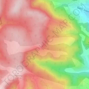
Name: Olaga topographic map, elevation, terrain.
Location: Olaga, Goñi, Comarca de Pamplona, Navarra, España (42.82789 -1.92639 42.84789 -1.90639)
Average elevation: 1,019 m
Minimum elevation: 801 m
Maximum elevation: 1,137 m
Thank you for supporting this site ❤️
Make a donation
Make a donation
Gear up for your next adventure:
As an Amazon Associate, this site earns from qualifying purchases at no extra cost to you.