
Edelsberg topographic map
Interactive map
Click on the map to display elevation.
About this map
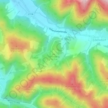
Name: Edelsberg topographic map, elevation, terrain.
Average elevation: 710 m
Minimum elevation: 565 m
Maximum elevation: 939 m
Other topographic maps
Click on a map to view its topography, its elevation and its terrain.
Hadersdorf
Österreich > Steiermark > Bezirk Bruck-Mürzzuschlag > Kindberg > Leopersdorf
Hadersdorf, Leopersdorf, Kindberg, Sankt Barbara im Mürztal, Bezirk Bruck-Mürzzuschlag, Steiermark, 8650, Österreich
Average elevation: 669 m