
Make a donation
Gear up for your next adventure:
As an Amazon Associate, this site earns from qualifying purchases at no extra cost to you.
Lahar topographic map
Click on the map to display elevation.
Make a donation
Gear up for your next adventure:
As an Amazon Associate, this site earns from qualifying purchases at no extra cost to you.
Lahar
Lahar is located at 26°07′N 78°34′E / 26.11°N 78.56°E / 26.11; 78.56. It has an average elevation of 275 metres (902 feet). Sports facilities in Lahar including a cricket stadium named after Indira Gandhi.
Make a donation
Gear up for your next adventure:
As an Amazon Associate, this site earns from qualifying purchases at no extra cost to you.
About this map
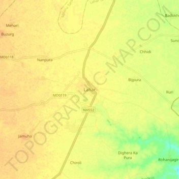
Name: Lahar topographic map, elevation, terrain.
Location: Lahar, Lahar Tahsil, Bhind, Madhya Pradesh, 477445, India (26.15252 78.90261 26.23252 78.98261)
Average elevation: 155 m
Minimum elevation: 134 m
Maximum elevation: 162 m
Make a donation
Gear up for your next adventure:
As an Amazon Associate, this site earns from qualifying purchases at no extra cost to you.