Geolocate

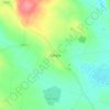
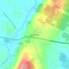
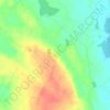
Rathconor topographic map

Click on the map to display elevation.

About this map

Name: Rathconor topographic map, elevation, terrain.

Location: Rathconor, Cams Electoral Division, Roscommon Municipal District, County Roscommon, Connacht, Ireland (53.67437 -8.25059 53.69684 -8.20252)

Average elevation: 90 m

Minimum elevation: 66 m

Maximum elevation: 129 m

Other topographic maps

Click on a map to view its topography, its elevation and its terrain.
Arigna

Ireland > County Roscommon

Average elevation: 122 m

Rahara

Ireland > County Roscommon

Average elevation: 88 m

Roosky

Ireland > County Roscommon

Average elevation: 46 m

Rathcroghan Mound

Ireland > County Roscommon

Average elevation: 127 m

Doon Point

Ireland > County Roscommon

Average elevation: 66 m

Ballinphuill

Ireland > County Roscommon

Average elevation: 57 m

Scramoge

Ireland > County Roscommon > Scramoge

Average elevation: 70 m

Ballybay

Ireland > County Roscommon

Average elevation: 40 m

Lisacul

Ireland > County Roscommon

Average elevation: 82 m

Granlahan

Ireland > County Roscommon

Average elevation: 105 m

Boyle Canal

Ireland > County Roscommon > Boyle

Average elevation: 68 m

Rathcroghan Mound

Ireland > County Roscommon

Average elevation: 127 m

Termon River

Ireland > County Roscommon

Average elevation: 75 m

Gear up for your next adventure:

🎒Multi-day Trekking Packs - Large capacity backpacks for wild camping and long-distance trails
🧭Professional Hiking Compasses - High-precision liquid-filled compasses for map reading and orientation
🧺Microfibre Travel Towels - Fast-drying and compact towels for wild swimming and camping
🥫Expedition Meals - Lightweight, high-calorie nutrition for long-distance hikers
⛺Camping Shelters - Emergency and lightweight shelters for outdoor use

As an Amazon Associate, this site earns from qualifying purchases at no extra cost to you.