
Eison (St-Martin) topographic map
Interactive map
Click on the map to display elevation.
About this map
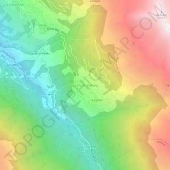
Name: Eison (St-Martin) topographic map, elevation, terrain.
Average elevation: 1,761 m
Minimum elevation: 944 m
Maximum elevation: 2,849 m
Other topographic maps
Click on a map to view its topography, its elevation and its terrain.
Suen (St-Martin)
Schweiz > Wallis > Ering > Saint-Martin (VS)
Suen (St-Martin), Saint-Martin (VS), Ering, Wallis, 1969, Schweiz
Average elevation: 1,314 m