
Hanksville topographic map
Interactive map
Click on the map to display elevation.
About this map
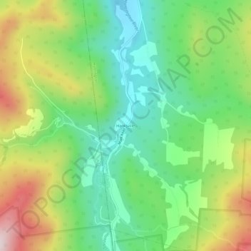
Name: Hanksville topographic map, elevation, terrain.
Average elevation: 426 m
Minimum elevation: 232 m
Maximum elevation: 749 m
Other topographic maps
Click on a map to view its topography, its elevation and its terrain.
Camels Hump
United States > Vermont > Chittenden County > Huntington
The summit of Camel's Hump is home to 10 acres (4 ha) of alpine tundra vegetation. Common plants found in this area include: Bigelow's sedge (Carex bigelowii), alpine bilberry (Vaccinium uliginosum), mountain sandwort (Minuartia groenlandica), crowberry (Empetrum nigrum), mountain cranberry (Vaccinium…
Average elevation: 843 m