
Waldtann topographic map
Interactive map
Click on the map to display elevation.
About this map
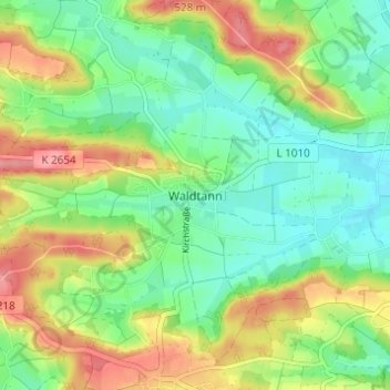
Name: Waldtann topographic map, elevation, terrain.
Average elevation: 485 m
Minimum elevation: 450 m
Maximum elevation: 540 m
Other topographic maps
Click on a map to view its topography, its elevation and its terrain.
Schönbronn
Deutschland > Baden-Württemberg > Landkreis Schwäbisch Hall > Kreßberg
Schönbronn, Kreßberg, Verwaltungsverband Fichtenau, Landkreis Schwäbisch Hall, Baden-Württemberg, 74594, Deutschland
Average elevation: 483 m
Tempelhof
Deutschland > Baden-Württemberg > Landkreis Schwäbisch Hall > Kreßberg > Tempelhof
Tempelhof, Kreßberg, Verwaltungsverband Fichtenau, Landkreis Schwäbisch Hall, Baden-Württemberg, 74594, Deutschland
Average elevation: 476 m