
Remchi topographic map
Interactive map
Click on the map to display elevation.
About this map
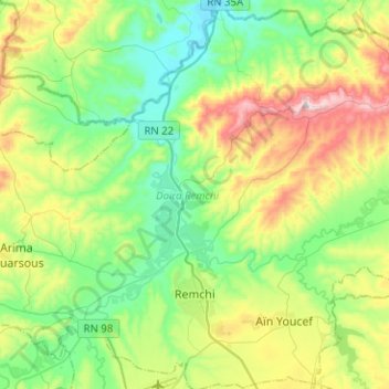
Name: Remchi topographic map, elevation, terrain.
Location: Remchi, Remchi District, Tilimsen, Algeria (35.01102 -1.51092 35.21703 -1.38430)
Average elevation: 218 m
Minimum elevation: 16 m
Maximum elevation: 657 m