
Centinela topographic map
Interactive map
Click on the map to display elevation.
About this map
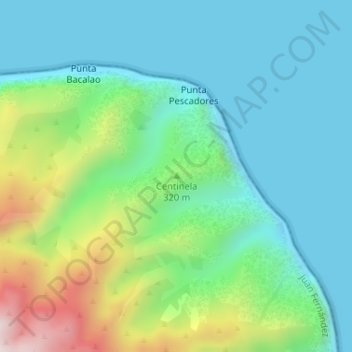
Name: Centinela topographic map, elevation, terrain.
Average elevation: 160 m
Minimum elevation: 0 m
Maximum elevation: 618 m
Other topographic maps
Click on a map to view its topography, its elevation and its terrain.
Isla Robinson Crusoe
Chile > Región de Valparaíso > Juan Fernández
Isla Robinson Crusoe, Juan Fernández, Provincia de Valparaíso, Región de Valparaíso, Chile
Average elevation: 44 m