
Sfisef topographic map
Interactive map
Click on the map to display elevation.
About this map
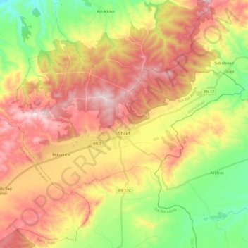
Name: Sfisef topographic map, elevation, terrain.
Location: Sfisef, Sfisef District, Sidi Bel Abbès, Algeria (35.18807 -0.36224 35.29716 -0.12934)
Average elevation: 544 m
Minimum elevation: 271 m
Maximum elevation: 822 m