
Thank you for supporting this site ❤️
Make a donation
Make a donation
Gear up for your next adventure:
As an Amazon Associate, this site earns from qualifying purchases at no extra cost to you.
Liepas topographic map
Click on the map to display elevation.
Thank you for supporting this site ❤️
Make a donation
Make a donation
Gear up for your next adventure:
As an Amazon Associate, this site earns from qualifying purchases at no extra cost to you.
About this map
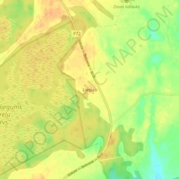
Name: Liepas topographic map, elevation, terrain.
Location: Liepas, Zasas pagasts, Jēkabpils novads, Zemgale, Latvia (56.23306 26.00000 56.27306 26.04000)
Average elevation: 115 m
Minimum elevation: 96 m
Maximum elevation: 126 m
Thank you for supporting this site ❤️
Make a donation
Make a donation
Gear up for your next adventure:
As an Amazon Associate, this site earns from qualifying purchases at no extra cost to you.