
Les Cloux topographic map
Interactive map
Click on the map to display elevation.
About this map
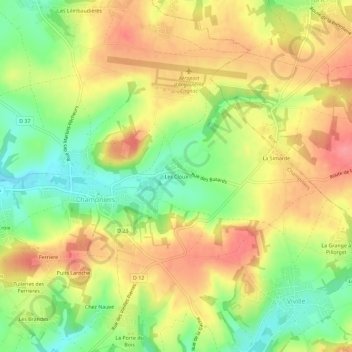
Name: Les Cloux topographic map, elevation, terrain.
Average elevation: 111 m
Minimum elevation: 67 m
Maximum elevation: 149 m
Other topographic maps
Click on a map to view its topography, its elevation and its terrain.
Puits Laroche
France > Nouvelle-Aquitaine > Charente > Champniers
Puits Laroche, Champniers, Angoulême, Charente, Nouvelle-Aquitaine, France métropolitaine, 16430, France
Average elevation: 93 m