
San Martin de Tor - San Martino in Badia - St. Martin in Thurn topographic map
Interactive map
Click on the map to display elevation.
About this map
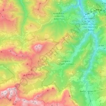
Name: San Martin de Tor - San Martino in Badia - St. Martin in Thurn topographic map, elevation, terrain.
Average elevation: 1,837 m
Minimum elevation: 1,047 m
Maximum elevation: 2,973 m
Other topographic maps
Click on a map to view its topography, its elevation and its terrain.
Antermëia - Untermoi - Antermoia
Italië > Trentino-Zuid-Tirol > Bolzano - Bozen > San Martin de Tor - San Martino in Badia - St. Martin in Thurn
Antermëia - Untermoi - Antermoia, San Martin de Tor - San Martino in Badia - St. Martin in Thurn, Pustertal - Val Pusteria, Bolzano - Bozen, Trentino-Zuid-Tirol, 39030, Italië
Average elevation: 1,677 m