Geolocate

Maryland City topographic map

Click on the map to display elevation.

About this map

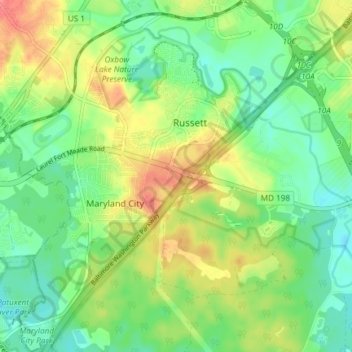
Name: Maryland City topographic map, elevation, terrain.

Location: Maryland City, Anne Arundel County, Maryland, 20724, United States (39.06778 -76.84033 39.12522 -76.76952)

Average elevation: 53 m

Minimum elevation: 25 m

Maximum elevation: 97 m

Gear up for your next adventure:

🦶Anti-Blister Balms - Protect your feet before long topographic expeditions
🧵Survival Paracord - Multi-purpose cordage for emergency repairs and shelters
🎿Telescopic Trekking Poles - Reduces knee strain on steep topographic descents
🕶️Glacier Goggles - Maximum protection for high-altitude snow topography
🥤Hydration Bladders - Hands-free hydration systems for backpacks

As an Amazon Associate, this site earns from qualifying purchases at no extra cost to you.