
Roßtal topographic map
Interactive map
Click on the map to display elevation.
About this map
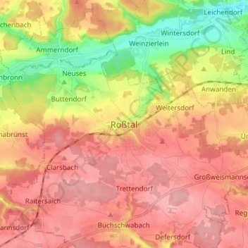
Name: Roßtal topographic map, elevation, terrain.
Location: Roßtal, Landkreis Fürth, Bayern, 90574, Deutschland (49.35779 10.84491 49.43779 10.92491)
Average elevation: 369 m
Minimum elevation: 296 m
Maximum elevation: 418 m