Geolocate

Moreh topographic map

Click on the map to display elevation.

About this map

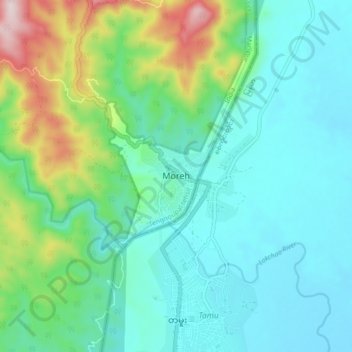
Name: Moreh topographic map, elevation, terrain.

Location: Moreh, Tengnoupal tehsil, Tengnoupal, Manipur, 795131, India (24.20812 94.26287 24.28812 94.34287)

Average elevation: 270 m

Minimum elevation: 149 m

Maximum elevation: 681 m

Gear up for your next adventure:

🐕Dog Hiking Gear - Equipment for hiking safely with dogs
🧺Ultralight Dry Bags - Organize and waterproof your gear inside your rucksack
🧤Hiking Gloves - Warm and durable gloves for cold-weather walks
🔋Lithium AA Batteries - Long-lasting power that performs well in cold mountain weather
🚲Cycling GPS Computers - Track elevation and topographic routes on two wheels

As an Amazon Associate, this site earns from qualifying purchases at no extra cost to you.