
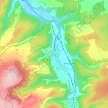
Courtemaîche topographic map
Interactive map
Click on the map to display elevation.
About this map
Name: Courtemaîche topographic map, elevation, terrain.
Average elevation: 486 m
Minimum elevation: 381 m
Maximum elevation: 616 m
Other topographic maps
Click on a map to view its topography, its elevation and its terrain.
Le Mairâ
Suisse > Jura > District de Porrentruy > Basse-Allaine
Le Mairâ, Basse-Allaine, District de Porrentruy, Jura, 2915, Suisse
Average elevation: 504 m