
Farr Bay topographic map
Interactive map
Click on the map to display elevation.
About this map
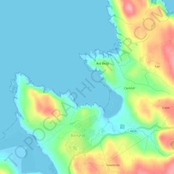
Name: Farr Bay topographic map, elevation, terrain.
Location: Farr Bay, Bettyhill, Scotland, KW14 7SY, United Kingdom (58.53544 -4.21992 58.53554 -4.21982)
Average elevation: 30 m
Minimum elevation: 0 m
Maximum elevation: 109 m