
Betesa topographic map
Interactive map
Click on the map to display elevation.
About this map
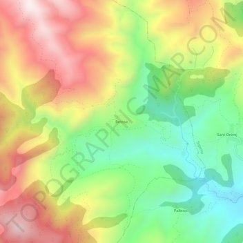
Name: Betesa topographic map, elevation, terrain.
Location: Betesa, Arén, Ribagorce, Huesca, Aragon, Espagne (42.33255 0.67183 42.37255 0.71183)
Average elevation: 1,206 m
Minimum elevation: 858 m
Maximum elevation: 1,599 m