
Thank you for supporting this site ❤️
Make a donation
Make a donation
Gear up for your next adventure:
As an Amazon Associate, this site earns from qualifying purchases at no extra cost to you.
Vermilion topographic map
Click on the map to display elevation.
Thank you for supporting this site ❤️
Make a donation
Make a donation
Gear up for your next adventure:
As an Amazon Associate, this site earns from qualifying purchases at no extra cost to you.
About this map
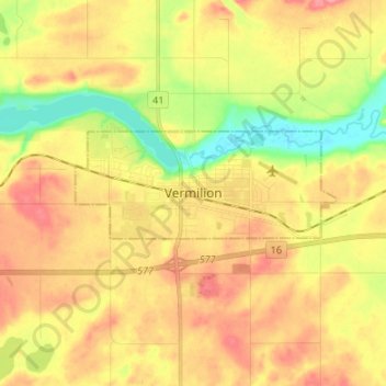
Name: Vermilion topographic map, elevation, terrain.
Location: Vermilion, Town of Vermilion, Alberta, T9X 1B7, Canada (53.31271 -110.89421 53.39271 -110.81421)
Average elevation: 616 m
Minimum elevation: 571 m
Maximum elevation: 652 m
Thank you for supporting this site ❤️
Make a donation
Make a donation
Gear up for your next adventure:
As an Amazon Associate, this site earns from qualifying purchases at no extra cost to you.