Geolocate

Duffus topographic map

Click on the map to display elevation.

About this map

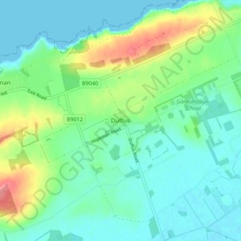
Name: Duffus topographic map, elevation, terrain.

Location: Duffus, Moray, Scotland, IV30 5QL, United Kingdom (57.68098 -3.41456 57.72098 -3.37456)

Average elevation: 21 m

Minimum elevation: 0 m

Maximum elevation: 77 m

Moray trails, hiking, mountain biking, running and outdoor activities

Gear up for your next adventure:

🦶Anti-Blister Balms - Protect your feet before long topographic expeditions
🧺Microfibre Travel Towels - Fast-drying and compact towels for wild swimming and camping
📱Phone Mounts for Hiking - Secure mounts to carry your phone on trails
🗺️Scratch-off Peak Maps - Track your progress climbing Munros or Wainwrights
🍲Portable Camping Stoves - Fast-boiling stoves for hot meals on remote topographic survey trips

As an Amazon Associate, this site earns from qualifying purchases at no extra cost to you.