
Brenner Pass topographic map
Click on the map to display elevation.
Brenner Pass
The Brenner Pass (German: Brennerpass [ˈbʁɛnɐpas], shortly Brenner; Italian: Passo del Brennero [ˈpasso del ˈbrɛnnero]) is a mountain pass over the Alps which forms the border between Italy and Austria. It is one of the principal passes of the Eastern Alpine range and has the lowest altitude among Alpine passes of the area.
About this map
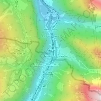
Name: Brenner Pass topographic map, elevation, terrain.
Average elevation: 1,635 m
Minimum elevation: 1,309 m
Maximum elevation: 2,252 m