Geolocate

Dan Issa topographic map

Click on the map to display elevation.

About this map

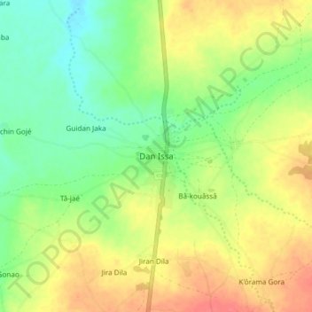
Name: Dan Issa topographic map, elevation, terrain.

Location: Dan Issa, Madarounfa, Maradi Region, Niger (13.16522 7.21733 13.24522 7.29733)

Average elevation: 394 m

Minimum elevation: 368 m

Maximum elevation: 424 m

Gear up for your next adventure:

🕶️Glacier Goggles - Maximum protection for high-altitude snow topography
🎒Multi-day Trekking Packs - Large capacity backpacks for wild camping and long-distance trails
🧢Waterproof Hiking Hats - Keep the rain off your face while studying topographic maps
📱Phone Mounts for Hiking - Secure mounts to carry your phone on trails
🌦️Portable Weather Meters - Handheld tools for monitoring weather conditions

As an Amazon Associate, this site earns from qualifying purchases at no extra cost to you.