Geolocate

Genolier topographic map

Click on the map to display elevation.

About this map

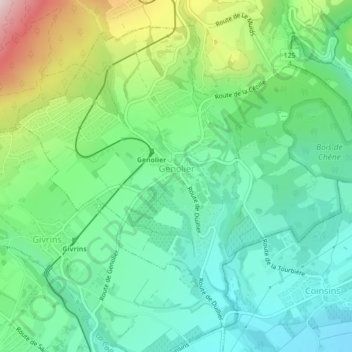
Name: Genolier topographic map, elevation, terrain.

Location: Genolier, District de Nyon, Vaud, 1272, Switzerland (46.42144 6.19819 46.44724 6.24179)

Average elevation: 564 m

Minimum elevation: 438 m

Maximum elevation: 859 m

Other topographic maps

Click on a map to view its topography, its elevation and its terrain.

Gear up for your next adventure:

💧Hydration Reservoirs - Convenient water bladders for hands-free drinking on the move
🧺Ultralight Dry Bags - Organize and waterproof your gear inside your rucksack
🧺Mesh Stuff Sacks - Breathable storage for wet gear or camp organization
🔥Emergency Fire Starters - Reliable ignition tools for survival situations in damp conditions
🧭Orienteering Compasses - Accurate compasses for map-based navigation

As an Amazon Associate, this site earns from qualifying purchases at no extra cost to you.