
บ้านซับเปิบ topographic map
Interactive map
Click on the map to display elevation.
About this map
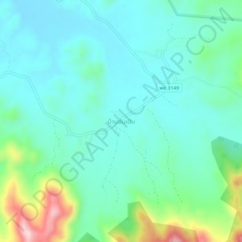
Name: บ้านซับเปิบ topographic map, elevation, terrain.
Location: บ้านซับเปิบ, Phetchabun (provincie), Thailand (16.32784 100.90672 16.36784 100.94672)
Average elevation: 228 m
Minimum elevation: 159 m
Maximum elevation: 466 m
Other topographic maps
Click on a map to view its topography, its elevation and its terrain.
เพชรบูรณ์
Thailand > Phetchabun (provincie)
เพชรบูรณ์, Phetchabun (provincie), 67000, Thailand
Average elevation: 120 m