
Corte do Pinto topographic map
Interactive map
Click on the map to display elevation.
About this map
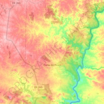
Name: Corte do Pinto topographic map, elevation, terrain.
Location: Corte do Pinto, Mértola, Beja, Portugal (37.66159 -7.53767 37.77201 -7.42635)
Average elevation: 159 m
Minimum elevation: 54 m
Maximum elevation: 236 m
Other topographic maps
Click on a map to view its topography, its elevation and its terrain.