
Vestvik topographic map
Interactive map
Click on the map to display elevation.
About this map
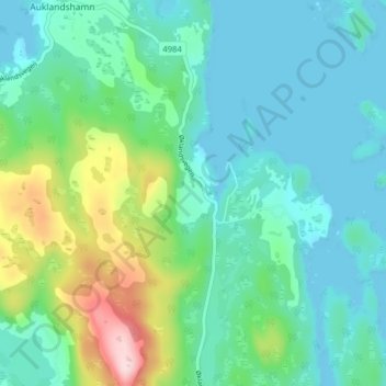
Name: Vestvik topographic map, elevation, terrain.
Location: Vestvik, Sveio, Vestland, 5551, Norwegen (59.59927 5.38937 59.63927 5.42937)
Average elevation: 59 m
Minimum elevation: 0 m
Maximum elevation: 259 m
Other topographic maps
Click on a map to view its topography, its elevation and its terrain.
Åkrafjorden
Norwegen > Vestland > Skånevik
Åkrafjorden, Skånevik, Etne, Vestland, 5596, Norwegen
Average elevation: 596 m
Austerdalsbreen
Austerdalsbreen, Luster, Vestland, Norwegen
Average elevation: 908 m
Hermansverk
Hermansverk, Sogndal, Vestland, 6863, Norwegen
Average elevation: 164 m