
Kazimierz Dolny topographic map
Interactive map
Click on the map to display elevation.
About this map
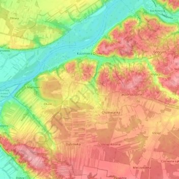
Name: Kazimierz Dolny topographic map, elevation, terrain.
Average elevation: 172 m
Minimum elevation: 110 m
Maximum elevation: 217 m
Other topographic maps
Click on a map to view its topography, its elevation and its terrain.
Nałęczów
Poland > Lublin Voivodeship > Puławy County
Nałęczów, gmina Nałęczów, Puławy County, Lublin Voivodeship, 24-140, Poland
Average elevation: 194 m