
Masitise topographic map
Interactive map
Click on the map to display elevation.
About this map
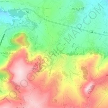
Name: Masitise topographic map, elevation, terrain.
Location: Masitise, Distrikt Quthing, Lesotho (-30.42518 27.61374 -30.38518 27.65374)
Average elevation: 1,605 m
Minimum elevation: 1,436 m
Maximum elevation: 1,793 m
Other topographic maps
Click on a map to view its topography, its elevation and its terrain.
Sebapala
Lesotho > Distrikt Quthing > Ha Robi
Sebapala, Ha Robi, Distrikt Quthing, Lesotho
Average elevation: 1,515 m