
Lemington topographic map
Interactive map
Click on the map to display elevation.
About this map
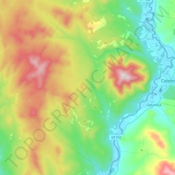
Name: Lemington topographic map, elevation, terrain.
Location: Lemington, Essex County, Vermont, United States (44.82448 -71.66369 44.95375 -71.49491)
Average elevation: 544 m
Minimum elevation: 300 m
Maximum elevation: 953 m
Other topographic maps
Click on a map to view its topography, its elevation and its terrain.
Maidstone
United States > Vermont > Essex County
Maidstone, Essex County, Vermont, 05905, United States
Average elevation: 404 m
Victory
United States > Vermont > Essex County
Victory, Essex County, Vermont, 05858, United States
Average elevation: 485 m
Lunenburg
United States > Vermont > Essex County
Lunenburg, Essex County, Vermont, United States
Average elevation: 375 m
Lewis Mountain
United States > Vermont > Essex County > Lewis
Lewis Mountain, Lewis, Essex County, Vermont, United States
Average elevation: 662 m