Geolocate

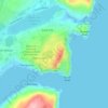
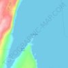
Downtown topographic map

Click on the map to display elevation.

About this map

Name: Downtown topographic map, elevation, terrain.

Location: Downtown, St. John's, Newfoundland, Newfoundland and Labrador, Canada (47.55737 -52.72005 47.57164 -52.69694)

Average elevation: 56 m

Minimum elevation: -4 m

Maximum elevation: 221 m

Other topographic maps

Click on a map to view its topography, its elevation and its terrain.
Gear up for your next adventure:

🗺️Ordnance Survey Maps - Essential paper maps for hiking across the UK national parks
❄️Walking Crampons - Added traction for icy slopes and winter peak bagging
📕Outdoor Navigation Books - Learn traditional and modern navigation techniques
🧊Insulated Flasks - Keeps drinks hot or cold during hikes
🔋Solar Power Banks - Keep your GPS and phone charged during multi-day expeditions

As an Amazon Associate, this site earns from qualifying purchases at no extra cost to you.