
Nachtigal topographic map
Interactive map
Click on the map to display elevation.
About this map
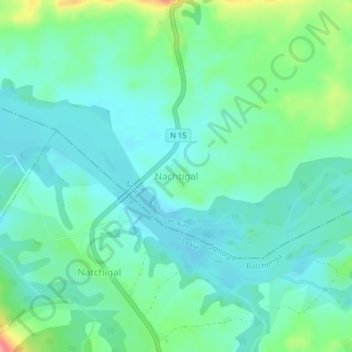
Name: Nachtigal topographic map, elevation, terrain.
Location: Nachtigal, Ntui, Mbam-et-Kim, Centre, Cameroon (4.33627 11.61224 4.37627 11.65224)
Average elevation: 452 m
Minimum elevation: 429 m
Maximum elevation: 523 m