
Rijeka Crnojevića topographic map
Interactive map
Click on the map to display elevation.
About this map
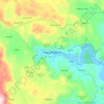
Name: Rijeka Crnojevića topographic map, elevation, terrain.
Location: Rijeka Crnojevića, Old Royal Capital Cetinje, Montenegro (42.31635 18.98265 42.39635 19.06265)
Average elevation: 330 m
Minimum elevation: -2 m
Maximum elevation: 923 m
Other topographic maps
Click on a map to view its topography, its elevation and its terrain.
Žanjev Do
Montenegro > Old Royal Capital Cetinje
Žanjev Do, Old Royal Capital Cetinje, 85339, Montenegro
Average elevation: 882 m
Jezerski
Montenegro > Old Royal Capital Cetinje > Mali Bostur
Jezerski, Mali Bostur, Old Royal Capital Cetinje, Montenegro
Average elevation: 1,342 m
Cetinje
Montenegro > Old Royal Capital Cetinje
Cetinje, Old Royal Capital Cetinje, Montenegro
Average elevation: 740 m