
Thank you for supporting this site ❤️
Make a donation
Make a donation
Gear up for your next adventure:
As an Amazon Associate, this site earns from qualifying purchases at no extra cost to you.
Gawanal topographic map
Click on the map to display elevation.
Thank you for supporting this site ❤️
Make a donation
Make a donation
Gear up for your next adventure:
As an Amazon Associate, this site earns from qualifying purchases at no extra cost to you.
About this map
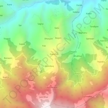
Name: Gawanal topographic map, elevation, terrain.
Location: Gawanal, Renuka, Sirmaur, Himachal Pradesh, 173032, India (30.69929 77.57224 30.73929 77.61224)
Average elevation: 1,727 m
Minimum elevation: 1,075 m
Maximum elevation: 2,553 m
Thank you for supporting this site ❤️
Make a donation
Make a donation
Gear up for your next adventure:
As an Amazon Associate, this site earns from qualifying purchases at no extra cost to you.