Geolocate

Sidi Saada topographic map

Click on the map to display elevation.

About this map
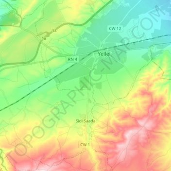
Name: Sidi Saada topographic map, elevation, terrain.

Location: Sidi Saada, Yellel District, Relizane, 48000, Algeria (35.64170 0.22720 35.75840 0.35080)

Average elevation: 199 m

Minimum elevation: 73 m

Maximum elevation: 400 m

Gear up for your next adventure:

🔋Power Banks - Portable chargers for long outdoor trips
🪢Paracord - Multi-purpose cord for camping and survival
🛌Sleeping Bags - Warm and packable sleeping bags for outdoor nights
⛺Camping Shelters - Emergency and lightweight shelters for outdoor use
🧦Hiking Socks - Breathable socks designed to prevent blisters on long walks

As an Amazon Associate, this site earns from qualifying purchases at no extra cost to you.