
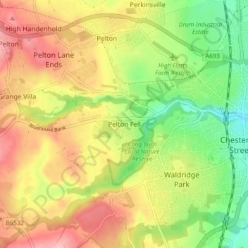
Pelton Fell topographic map
Interactive map
Click on the map to display elevation.
About this map
Name: Pelton Fell topographic map, elevation, terrain.
Average elevation: 76 m
Minimum elevation: 10 m
Maximum elevation: 140 m
County Durham trails, hiking, mountain biking, running and outdoor activities
Other topographic maps
Click on a map to view its topography, its elevation and its terrain.
Flass Vale Local Nature Reserve
United Kingdom > England > County Durham > Durham
Average elevation: 81 m