
Slaton topographic map
Click on the map to display elevation.
About this map
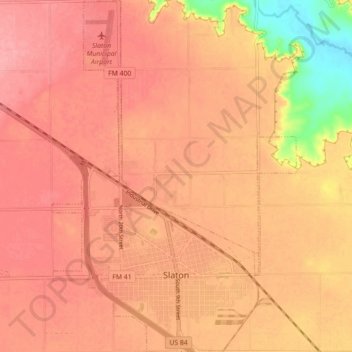
Name: Slaton topographic map, elevation, terrain.
Location: Slaton, Lubbock County, Texas, 79364, United States (33.41804 -101.67502 33.49204 -101.61314)
Average elevation: 937 m
Minimum elevation: 868 m
Maximum elevation: 963 m
Other topographic maps
Click on a map to view its topography, its elevation and its terrain.
Roosevelt
United States > Texas > Lubbock County
Roosevelt is an unincorporated community in Lubbock County, Texas, United States. It sits at an elevation of 3136 feet (956 m). The community is part of the Lubbock Metropolitan Statistical Area. It mainly consists of Roosevelt High school. There is also a Baptist church here.
Average elevation: 957 m
Buffalo Springs Lake
United States > Texas > Lubbock County > Buffalo Springs
Average elevation: 947 m