
Drangkhok Tso topographic map
Interactive map
Click on the map to display elevation.
About this map
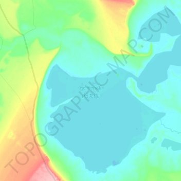
Name: Drangkhok Tso topographic map, elevation, terrain.
Location: Drangkhok Tso, Baingoin County, Nagqu City, Tibet, China (31.67293 89.42588 31.82284 89.61704)
Average elevation: 4,552 m
Minimum elevation: 4,524 m
Maximum elevation: 4,658 m
Other topographic maps
Click on a map to view its topography, its elevation and its terrain.
Machen
China > Tibet > Baingoin County
Machen, Baingoin County, Nagqu City, Tibet, China
Average elevation: 4,735 m