
Coweta topographic map
Interactive map
Click on the map to display elevation.
About this map
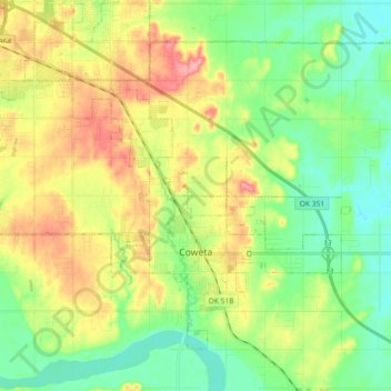
Name: Coweta topographic map, elevation, terrain.
Location: Coweta, Wagoner County, Oklahoma, United States (35.91572 -95.76096 36.03138 -95.57869)
Average elevation: 195 m
Minimum elevation: 159 m
Maximum elevation: 250 m
Other topographic maps
Click on a map to view its topography, its elevation and its terrain.
Porter
United States > Oklahoma > Wagoner County
Porter, Wagoner County, Oklahoma, 74454, United States
Average elevation: 190 m