
Thank you for supporting this site ❤️
Make a donation
Make a donation
Gear up for your next adventure:
As an Amazon Associate, this site earns from qualifying purchases at no extra cost to you.
Elcetina topographic map
Click on the map to display elevation.
Thank you for supporting this site ❤️
Make a donation
Make a donation
Gear up for your next adventure:
As an Amazon Associate, this site earns from qualifying purchases at no extra cost to you.
About this map
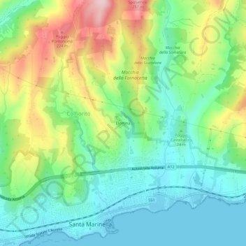
Name: Elcetina topographic map, elevation, terrain.
Location: Elcetina, Santa Marinella, Roma Capitale, Lazio, 00058, Italy (42.03189 11.85510 42.07189 11.89510)
Average elevation: 85 m
Minimum elevation: -1 m
Maximum elevation: 252 m
Thank you for supporting this site ❤️
Make a donation
Make a donation
Gear up for your next adventure:
As an Amazon Associate, this site earns from qualifying purchases at no extra cost to you.