
Cedar Lake topographic map
Interactive map
Click on the map to display elevation.
About this map
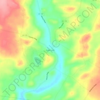
Name: Cedar Lake topographic map, elevation, terrain.
Average elevation: 440 m
Minimum elevation: 384 m
Maximum elevation: 503 m
Other topographic maps
Click on a map to view its topography, its elevation and its terrain.
Days Corners
United States > New York > Herkimer County > Town of Litchfield
Days Corners, Town of Litchfield, Herkimer County, New York, 13322, United States
Average elevation: 442 m
Norwich Corners
United States > New York > Herkimer County > Town of Litchfield
Norwich Corners, Town of Litchfield, Herkimer County, New York, 13456, United States
Average elevation: 385 m
Cranes Corners
United States > New York > Herkimer County > Town of Litchfield
Cranes Corners, Town of Litchfield, Herkimer County, New York, United States
Average elevation: 421 m