
Thank you for supporting this site ❤️
Make a donation
Make a donation
Gear up for your next adventure:
As an Amazon Associate, this site earns from qualifying purchases at no extra cost to you.
Rivetto topographic map
Click on the map to display elevation.
Thank you for supporting this site ❤️
Make a donation
Make a donation
Gear up for your next adventure:
As an Amazon Associate, this site earns from qualifying purchases at no extra cost to you.
About this map
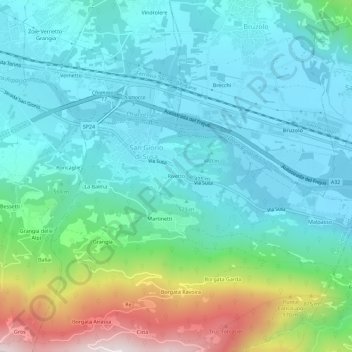
Name: Rivetto topographic map, elevation, terrain.
Location: Rivetto, San Giorio di Susa, Turin, Piedmont, 10053, Italy (45.10524 7.16282 45.14524 7.20282)
Average elevation: 583 m
Minimum elevation: 401 m
Maximum elevation: 1,206 m
Thank you for supporting this site ❤️
Make a donation
Make a donation
Gear up for your next adventure:
As an Amazon Associate, this site earns from qualifying purchases at no extra cost to you.