
La Sarine topographic map
Interactive map
Click on the map to display elevation.
About this map
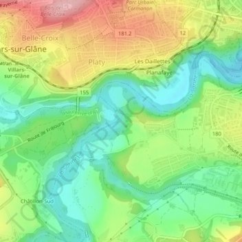
Name: La Sarine topographic map, elevation, terrain.
Location: La Sarine, Marly, Sarine District, Fribourg, 1752, Switzerland (46.78255 7.13209 46.78399 7.13369)
Average elevation: 622 m
Minimum elevation: 552 m
Maximum elevation: 726 m
Other topographic maps
Click on a map to view its topography, its elevation and its terrain.
La Sarine
Switzerland > Fribourg > Sarine District > Marly
La Sarine, Marly, Sarine District, Fribourg, 1752, Switzerland
Average elevation: 621 m