
Rouvray-Saint-Florentin topographic map
Interactive map
Click on the map to display elevation.
About this map
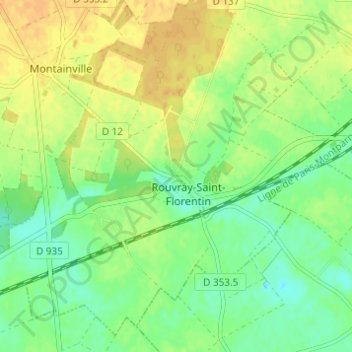
Name: Rouvray-Saint-Florentin topographic map, elevation, terrain.
Average elevation: 148 m
Minimum elevation: 134 m
Maximum elevation: 160 m
Other topographic maps
Click on a map to view its topography, its elevation and its terrain.
Les Villages Vovéens
France > Centre-Val de Loire > Les Villages Vovéens
Les Villages Vovéens, Chartres, Eure-et-Loir, Centre-Val de Loire, France métropolitaine, 28150, France
Average elevation: 148 m