
Cañete topographic map
Interactive map
Click on the map to display elevation.
About this map
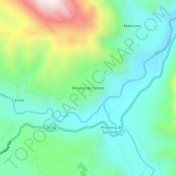
Name: Cañete topographic map, elevation, terrain.
Location: Cañete, Mazamari, Province of Satipo, Junín, 12261, Peru (-11.33888 -74.50943 -11.29888 -74.46943)
Average elevation: 720 m
Minimum elevation: 488 m
Maximum elevation: 1,312 m