
Aïn Torki topographic map
Interactive map
Click on the map to display elevation.
About this map
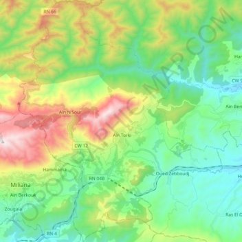
Name: Aïn Torki topographic map, elevation, terrain.
Location: Aïn Torki, Daïra Hammam Righa, Aïn Defla, Algérie (36.27006 2.22485 36.41667 2.37891)
Average elevation: 698 m
Minimum elevation: 305 m
Maximum elevation: 1,560 m